Professor Linwang Yuan was invited to attend the Symposium on “Remote Sensing of Resources and Environment and Application of Geospatial Information” of Yunnan Normal University

June 23-24, 2018, the symposium “Remote Sensing of Resources and Environment and Geospatial Information Applications”, hosted by the School of Tourism and Geography, the Key Laboratory of Resource and Environment Remote Sensing of Yunnan Province, and the Geospatial Information Engineering Technology Research Center of Yunnan Province, was held at Yunnan Normal University. The conference focused on the theme of “Development of Remote Sensing Technology in the New Age Resource Environment”.
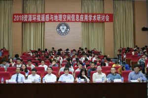
Professor Linwang Yuan was invited to attend the symposium and gave a report “Geometry Algebra and GIS: Mapping and Construction”, which analyzed the relationship between different disciplines and GIS from the point of view of mathematics and physics, and analyzed the application in GIS software.
 

Professor Linwang, Yuan was invited to Wuhan University for academic exchanges

June 4-5, 2018, at the invitation of Professor Lin Li, Department of Geographic Information and Map Science, Professor Linwang, Yuan went to the School of Resources and Environmental Sciences of Wuhan University for academic exchanges and made an academic report entitled “Geometry Algebra and GIS: Mapping and Construction”.

In his report, Professor Yuan introduced the basic methods and characteristics of the application of geometric algebra to geospatial data modeling and spatial analysis from the perspective of geospatial features, and particularly introduced his research achievements and progress in this direction in recent years. Show the application prospect of geometric algebra in multidimensional modeling and analysis of geospatial data.

Theory and method of spatial-temporal unified data model construction based on geometric algebra introduction to the popularization of project results

GIS data model is the basis of GIS data expression, organization, collection, analysis and transmission, and it is always the frontier and hotspot of GIS research.However, the existing GIS data model focuses on the expression of space or geometry, and the expression of time often adopts the discrete way, which leads to the imperfect expression of space, weak expression of time, insufficient expression of semantic and physical attribute and lack of expression of space-time relation.As an algebraic method to describe geometric problems, geometric algebra has the characteristics of unification of geometry and algebra, unification of time and space, multidimensional unification and unification of space-time expression and computation, and it is an effective mathematic tool to help GIS data model break through the above obstacles. Read More